|
Site Map
Click on the
following web pages for more offerings:
HOME
About Us
Colorado
Artifactual
Albertype
Publications
Aspen,
Colorado
Business
Directories
Colorado
Colorado
Bottles, historical
Colorado
Business Directories
Colorado Maps
Colorado
Mining Stock Certificates
Colorado
Whiskey Jugs, historical
Cripple Creek,
Colorado
Cripple
Creek Mining Directories
Cripple
Creek mining stock certificates
Denver and
Rio Grande Railroad
Einstein,
Albert
Feynman,
Richard P.
Fitzgerald, F.
Scott
Gunnison
County, Colorado, including Crested Butte
Hecht, Ben
Hemingway,
Ernest
Hutchinson
Soda Bottles
Jackson,
William Henry
Leadville,
Colorado
Leadville
Directories
San Juan
Mountains, Colorado
Silverton
Railroad
|
|
Yes, we Accept:
PAYPAL,
Venmo & SQUARE |
We
are always interested in purchasing, whether you have a single item or an entire
collection for sale.
© 2024 Mt. Gothic Tomes
| |
|
MAP
OF THE SAN JUAN TRIANGLE, 1903
Published
by George S. Clason, The Clason Map Company, Denver, Colorado |
|
Original
Map of the San Juan Triangle, Published by Geo. S. Clason, Draftsman, 315
Colorado Building, Denver. Copyrighted by Geo. S. Clason,
1903. Scale: 3,000 feet = 1 inch. |
|
Map
dimensions: 33-3/4 inches across by 28 inches in height. A
highly detailed mining district and claim map of southwestern
Colorado. Mining districts include: Ouray; Silverton;
Telluride. Colorado counties: Ouray; San Miguel; San Juan; and part
of Hinsdale. Hand-colored with several significant mineral producing
mines demarcated. Railroads, roads, major rivers and bodies of
water; townships, mining camps and towns identified. |
|
Condition:
very good plus; map details clear and concise; some markings on map from a
previous indicating productive mines; significant conservation on back of
map reinforcing hinges; from of map in near fine condition. Missing
original printed folder.
PRICE:
$2,500.00 |
|
WILLIAMS'
TOURISTS' GUIDE AND MAP OF THE SAN JUAN MINES OF COLORADO
1877 |
|
For
more details and digital images on Williams New Map of Colorado, Kansas,
and Routes of Travel to Health Resorts and Pleasure of Rocky Mountains,
1877, plus original promotional publication, please see the following web
page: San Juan Mountains, Colorado
|
|

|
|
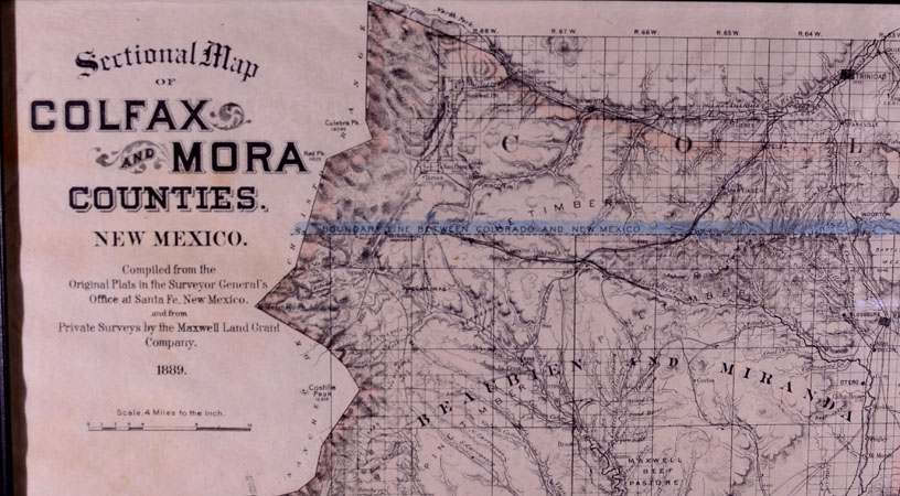
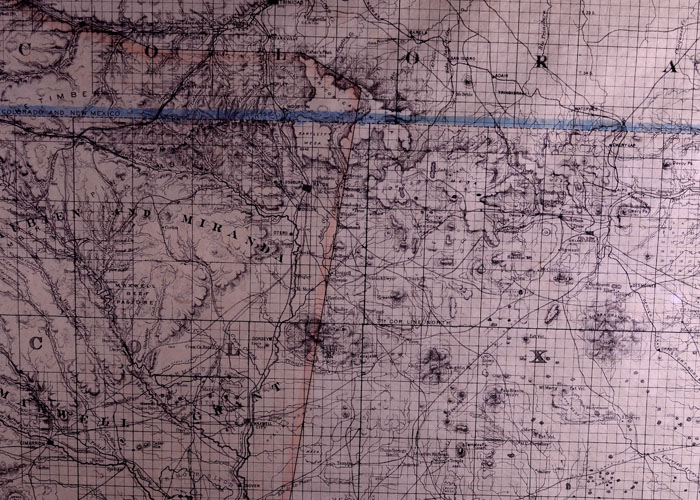
(Maxwell
Land Grant) SECTIONAL
MAP OF COLFAX AND MORA COUNTIES, NEW MEXICO.
Compiled from the Original Plats in the Surveyor General’s Office
at Santa Fe, New Mexico and from Private Surveys by the Maxwell Land Grant
Company, 1889. Scale: 4 miles
to the inch. Legend:
railroads; proposed railroads; wagon roads; trails; telephone lines; coal
veins and thickness in feet. Map
dimensions: 39 inches across by 29 inches in height.
Ranges and townships. Topographical
features. Villages and towns.
Near fine condition.
PRICE:
$750.00
|
|

|
|